How to hike Tsing Tai Stream
- Exploring Dogs
- Jun 22, 2022
- 3 min read

Updated: Jul 27, 2022
There’s no better way to beat the summer heat than with a good ol’ stream trek, and so long as you keep your wits about you and don’t do anything foolish - like attempt to scale the waterfall with dogs, or visit during heavy rain - it should be a good day out for everyone! This hidden gem of a trek along Tsing Tai (or Qing Dai) stream (青大石澗), will require you to get into the estuary and walk in the stream - there is no avoiding the water on this walk, and we would advise wearing stream trekking or water shoes with good grip, to protect your feet.

Overview
Distance: 4 kilometres approx.
Difficulty: Intermediate to advanced
Total ascent: 160 metres
Total time: 4 hours approx. (including rests) Shaded? None Water? Estuary and freshwater stream Verdict: Best not attempted during or after heavy rain
The start


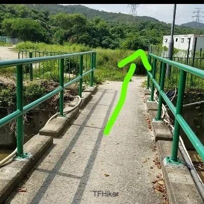
The walk starts just behind the kiosk (pictured) to the left, and goes through Ha Pak Nai (下白泥) Village back paths. Funnily enough, these little winding paths don’t seem to be accurately marked on Google Maps, but the goal is to get to this spot, where you will find some makeshift steps down into the stream, to the left of the bridge (pictured, bottom left). Before this, you will cross one stream via a bridge with green railings first (pictured, top right), but this is NOT the start, and you need to continue straight over this bridge and straight across this path.


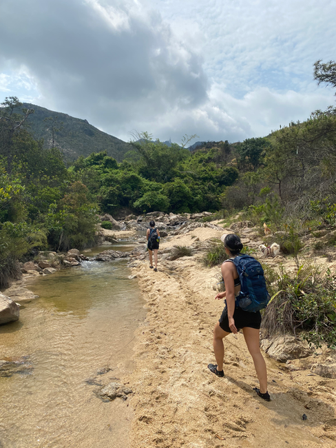
Once in the stream, it’s pretty plain sailing and you can set your own pace and path for the walk, and turn back whenever you are ready. There are also ribbons tied along the way to assist you in finding the most suitable path. However, if you want to get to the rock pool and waterfall at the end, read on.


At the Dam
About 20-30 minutes into the walk, you will hit this rather picturesque dam - you can either climb over the walls or walk around it on either side. The path to the left is a rather steep, but short path around the dam, or you could take the steps to your right, by the tower and turn left to go along a short bush-whacking path which will eventually lead you back out to the stream.
If you take this path behind the tower, there is a makeshift ladder to help you up a short concrete wall, which most athletic dogs can clear on their own - or require a (small) boost up.


Once past the dam, its another 20 minutes of stream trekking before you will reach the first pool, and a mini man-made hut and seating area to the right, making for the perfect pitstop. If you continue on, you will eventually reach your first fork in the stream. We advise taking a left, until you hit another fork, at which point you should continue straight (i.e. the stream to the right). This will eventually come out to a few waterfalls, and although at an incline, it is passable for both humans and dogs, though will involve some scrabbling. Eventually you will reach the final falls (pictured below), which is identifiable by a makeshift step ladder a previous visitor has installed.

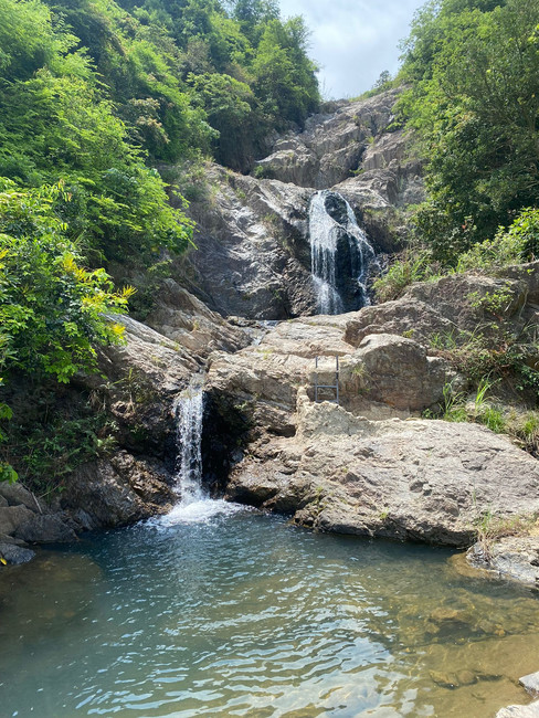

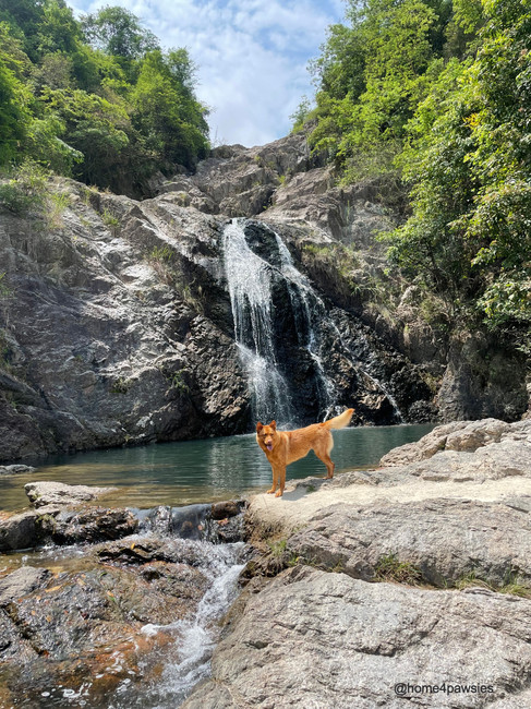
The Final Falls
Here, you will find a seating area for a nice pitstop, to refuel, grab a breather and enjoy a dip with the dogs in the pool, before you make your way back the way you came to the start of the walk again. *Please note: We do not advise attempting to go beyond this waterfall - especially with dogs, as there was once a fatal accident that took place here when a KOL attempted to take a photo of herself atop this waterfall. As always, you know yours and your dog’s limits best. Please be safe out there, and don’t do anything foolish.


Comments